Weather Alert in Alaska
Winter Storm Warning issued February 11 at 11:43AM AKST until February 12 at 3:00PM AKST by NWS Juneau AK
AREAS AFFECTED: Haines Borough and Klukwan
DESCRIPTION: ...ACCUMULATING SNOW FOR THE NORTHERN INNER CHANNELS... .A storm force system will be moving up into the panhandle late Wednesday night, bringing the next round of more significant snow to the Haines Highway and less so for the Klondike Highway. Precipitation may begin as rain or a rain/snow mix, however, as rates increase, precipitation is expected to transition to only snow. A majority of the higher snow rates are anticipated during the early morning hours of Thursday. At this time, rates have a 30-50% chance to exceed one inch per hour during the early morning hours for Haines and Haines Highway, and around a 30% chance to exceed half an inch per hour for Skagway and the Klondike Highway. * WHAT...Heavy snow expected. Total snow accumulations of 4 to 8 inches. * WHERE...Haines and Haines Highway. * WHEN...From midnight tonight to 3 PM AKST Thursday. * IMPACTS...Travel will be very difficult. * ADDITIONAL DETAILS...Heaviest snow rates, possibly greater than one inch per hour, are anticipated during the early morning hours of Thursday.
INSTRUCTION: If you must travel, keep an extra flashlight, food, and water with you in case of an emergency. People are urged to prepare their property before the onset of winter weather. For the latest road conditions, where available, call 5 1 1 or visit 511.alaska.gov.
Want more detail? Get the Complete 7 Day and Night Detailed Forecast!
Current U.S. National Radar--Current
The Current National Weather Radar is shown below with a UTC Time (subtract 5 hours from UTC to get Eastern Time).

National Weather Forecast--Current
The Current National Weather Forecast and National Weather Map are shown below.

National Weather Forecast for Tomorrow
Tomorrow National Weather Forecast and Tomorrow National Weather Map are show below.

North America Water Vapor (Moisture)
This map shows recent moisture content over North America. Bright and colored areas show high moisture (ie, clouds); brown indicates very little moisture present; black indicates no moisture.

Weather Topic: What is Evaporation?
Home - Education - Precipitation - Evaporation
 Next Topic: Fog
Evaporation is the process which returns water from the earth
back to the atmosphere, and is another crucial process in the water cycle.
Evaporation is the transformation of liquid into gas, and it happens because
molecules are excited by the application of energy and turn into vapor.
In order for water to evaporate it has to be on the surface of a body of water.
Next Topic: Fog
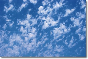
Weather Topic: What are Fractus Clouds?
Home - Education - Cloud Types - Fractus Clouds
 Next Topic: Freezing Rain
A fractus cloud (scud) is a fragmented, tattered cloud which has
likely been sheared off of another cloud. They are accessory clouds, meaning they
develop from parent clouds, and are named in a way which describes the original
cloud which contained them.
Fractus clouds which have originated from cumulus clouds are referred to as
cumulus fractus, while fractus clouds which have originated from stratus clouds
are referred to as stratus fractus. Under certain conditions a fractus cloud might
merge with another cloud, or develop into a cumulus cloud, but usually a
fractus cloud seen by itself will dissipate rapidly.
They are often observed on the leading and trailing edges of storm clouds,
and are a display of wind activity.
Next Topic: Freezing Rain
Current conditions powered by WeatherAPI.com


