Weather Alert in Illinois
Flood Watch issued April 3 at 10:58AM CDT until April 5 at 1:00PM CDT by NWS Chicago IL
AREAS AFFECTED: Winnebago
DESCRIPTION: ...The Flood Watch is extended for the following rivers in Illinois... Kishwaukee River near Perryville affecting Winnebago County. For the Kishwaukee River...including Perryville...flooding is possible. * WHAT...Flooding is possible. * WHERE...Kishwaukee River from Confluence with South Branch Kishwaukee River downstream to the Rock River, including the Perryville gauge. * WHEN...From this evening to early Sunday afternoon. * IMPACTS...At 13.0 feet, Roadways threatened at Blackhawk Valley Campground south of Rockford. * ADDITIONAL DETAILS... - At 10:30 AM CDT Friday the stage was 11.1 feet. - Forecast...Flood stage may be reached late this afternoon, however there is still some uncertainty regarding the river crest. - Flood stage is 12.0 feet. - http://www.weather.gov/safety/flood
INSTRUCTION: A Flood Watch means water levels above flood stage are possible, but not yet certain, based upon the latest forecasts. Persons along rivers and streams in the watch area should monitor the latest forecasts and be prepared to take action should flooding develop. These forecasts are based on observed precipitation as well as forecast precipitation 24 hours into the future. Changes to the rainfall forecast, or any additional rainfall after 24 hours, may cause changes to these river forecasts. Additional information is available at www.weather.gov. The next statement will be issued by late tonight.
Want more detail? Get the Complete 7 Day and Night Detailed Forecast!
Current U.S. National Radar--Current
The Current National Weather Radar is shown below with a UTC Time (subtract 5 hours from UTC to get Eastern Time).

National Weather Forecast--Current
The Current National Weather Forecast and National Weather Map are shown below.

National Weather Forecast for Tomorrow
Tomorrow National Weather Forecast and Tomorrow National Weather Map are show below.

North America Water Vapor (Moisture)
This map shows recent moisture content over North America. Bright and colored areas show high moisture (ie, clouds); brown indicates very little moisture present; black indicates no moisture.

Weather Topic: What is Evaporation?
Home - Education - Precipitation - Evaporation
 Next Topic: Fog
Evaporation is the process which returns water from the earth
back to the atmosphere, and is another crucial process in the water cycle.
Evaporation is the transformation of liquid into gas, and it happens because
molecules are excited by the application of energy and turn into vapor.
In order for water to evaporate it has to be on the surface of a body of water.
Next Topic: Fog
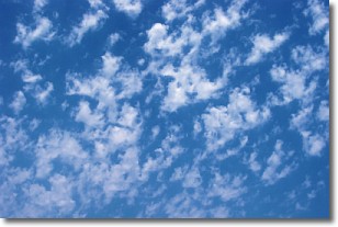
Weather Topic: What are Fractus Clouds?
Home - Education - Cloud Types - Fractus Clouds
 Next Topic: Freezing Rain
A fractus cloud (scud) is a fragmented, tattered cloud which has
likely been sheared off of another cloud. They are accessory clouds, meaning they
develop from parent clouds, and are named in a way which describes the original
cloud which contained them.
Fractus clouds which have originated from cumulus clouds are referred to as
cumulus fractus, while fractus clouds which have originated from stratus clouds
are referred to as stratus fractus. Under certain conditions a fractus cloud might
merge with another cloud, or develop into a cumulus cloud, but usually a
fractus cloud seen by itself will dissipate rapidly.
They are often observed on the leading and trailing edges of storm clouds,
and are a display of wind activity.
Next Topic: Freezing Rain
Current conditions powered by WeatherAPI.com


