Weather Alert in Indiana
Flood Warning issued March 9 at 10:02PM EDT until March 18 at 7:08PM EDT by NWS Indianapolis IN
AREAS AFFECTED: Daviess, IN; Gibson, IN; Knox, IN; Pike, IN
DESCRIPTION: ...The Flood Warning continues for the following rivers in Indiana... Illinois... White River at Edwardsport. White River at Newberry. White River at Elliston. White River at Hazleton. White River at Petersburg. Wabash River at Mount Carmel. .Minor to moderate flooding continue on the White River and minor flooding continues on the lower Wabash at Mount Carmel due to heavy rainfall last week. Additional rainfall of one to two inches Tuesday through Wednesday is expected to bring additional rises on the White and lengthen the amount of time in flood for the lower White. Additional flooding is possible on the lower Wabash as well, depending on the exact location of the rainfall. The crest on the White is near Edwardsport Monday morning and expected to reach Hazleton sometime Friday. * WHAT...Moderate flooding is occurring and minor flooding is forecast. * WHERE...White River at Edwardsport. * WHEN...Until Wednesday, March 18. * IMPACTS...At 22.9 feet, A 25 foot section of Levee Unit 8 failed at this level on March 6 2011...flooding local roads behind the levee. Flooding not nearly as bad as June 2008 levee failure. * ADDITIONAL DETAILS... - At 7:00 PM EDT Monday /6:00 PM CDT Monday/ the stage was 22.2 feet. - Recent Activity...The maximum river stage in the 24 hours ending at 7:00 PM EDT Monday /6:00 PM CDT Monday/ was 22.5 feet. - Forecast...The river is expected to fall below flood stage Wednesday, March 18 and continue falling and remain below flood stage. - Flood stage is 15.0 feet. - http://www.weather.gov/safety/flood
INSTRUCTION: Motorists should not attempt to drive around barricades or drive cars through flooded areas. Turn around, don't drown when encountering flooded roads. Most flood deaths occur in vehicles. Additional information is available at www.weather.gov/ind. The next statement should be issued Tuesday afternoon by around 115 PM EDT /1215 PM CDT/.
Want more detail? Get the Complete 7 Day and Night Detailed Forecast!
Current U.S. National Radar--Current
The Current National Weather Radar is shown below with a UTC Time (subtract 5 hours from UTC to get Eastern Time).

National Weather Forecast--Current
The Current National Weather Forecast and National Weather Map are shown below.

National Weather Forecast for Tomorrow
Tomorrow National Weather Forecast and Tomorrow National Weather Map are show below.

North America Water Vapor (Moisture)
This map shows recent moisture content over North America. Bright and colored areas show high moisture (ie, clouds); brown indicates very little moisture present; black indicates no moisture.

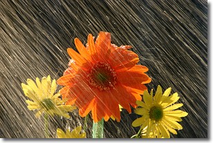
Weather Topic: What is Rain?
Home - Education - Precipitation - Rain
 Next Topic: Shelf Clouds
Precipitation in the form of water droplets is called rain.
Rain generally has a tendency to fall with less intensity over a greater period
of time, and when rainfall is more severe it is usually less sustained.
Rain is the most common form of precipitation and happens with greater frequency
depending on the season and regional influences. Cities have been shown to have
an observable effect on rainfall, due to an effect called the urban heat island.
Compared to upwind, monthly rainfall between twenty and forty miles downwind of
cities is 30% greater.
Next Topic: Shelf Clouds
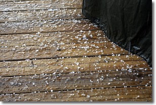
Weather Topic: What is Sleet?
Home - Education - Precipitation - Sleet
 Next Topic: Snow
Sleet is a form of precipitation in which small ice pellets are the primary
components. These ice pellets are smaller and more translucent than hailstones,
and harder than graupel. Sleet is caused by specific atmospheric conditions and
therefore typically doesn't last for extended periods of time.
The condition which leads to sleet formation requires a warmer body of air to be
wedged in between two sub-freezing bodies of air. When snow falls through a warmer
layer of air it melts, and as it falls through the next sub-freezing body of air
it freezes again, forming ice pellets known as sleet. In some cases, water
droplets don't have time to freeze before reaching the surface and the result is
freezing rain.
Next Topic: Snow
Current conditions powered by WeatherAPI.com


