Weather Alert in Colorado
Special Weather Statement issued August 27 at 3:38PM MDT by NWS Denver CO
AREAS AFFECTED: North Douglas County Below 6000 Feet/Denver/West Adams and Arapahoe Counties/East Broomfield County; Central and South Weld County; Morgan County; Central and East Adams and Arapahoe Counties
DESCRIPTION: At 338 PM MDT, Doppler radar was tracking a line of strong thunderstorms extending from over Weldona to 11 miles southeast of Hudson, or extending from 11 miles northwest of Fort Morgan to 27 miles northeast of Denver, moving southeast at 20 mph. HAZARD...Wind gusts up to 40 mph and penny size hail. SOURCE...Radar indicated. IMPACT...Gusty winds could knock down tree limbs and blow around unsecured objects. Minor damage to outdoor objects is possible. Locations impacted include... Fort Morgan, Bennett, Keenesburg, Wiggins, Log Lane Village, Hoyt, Orchard, Riverside Reservoir, Roggen, Goodrich, Jackson Reservoir, Prospect Valley, Weldona, Hoyt Beet Dump, Masters and Fort Morgan Airport.
INSTRUCTION: Monitor the weather situation closely and be alert for threatening weather conditions.
Want more detail? Get the Complete 7 Day and Night Detailed Forecast!
Current U.S. National Radar--Current
The Current National Weather Radar is shown below with a UTC Time (subtract 5 hours from UTC to get Eastern Time).

National Weather Forecast--Current
The Current National Weather Forecast and National Weather Map are shown below.

National Weather Forecast for Tomorrow
Tomorrow National Weather Forecast and Tomorrow National Weather Map are show below.

North America Water Vapor (Moisture)
This map shows recent moisture content over North America. Bright and colored areas show high moisture (ie, clouds); brown indicates very little moisture present; black indicates no moisture.

Weather Topic: What are Nimbostratus Clouds?
Home - Education - Cloud Types - Nimbostratus Clouds
 Next Topic: Precipitation
A nimbostratus cloud is similar to a stratus cloud in its formless,
smooth appearance. However, a nimbostratus cloud is darker than a stratus cloud,
because it is thicker.
Unlike a stratus cloud, a nimbostratus cloud typically brings with it the threat
of moderate to heavy precipitation. In some cases, the precipitation may evaporate
before reaching the ground, a phenomenon known as virga.
Next Topic: Precipitation
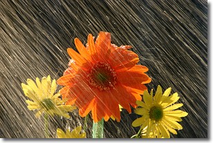
Weather Topic: What is Rain?
Home - Education - Precipitation - Rain
 Next Topic: Shelf Clouds
Precipitation in the form of water droplets is called rain.
Rain generally has a tendency to fall with less intensity over a greater period
of time, and when rainfall is more severe it is usually less sustained.
Rain is the most common form of precipitation and happens with greater frequency
depending on the season and regional influences. Cities have been shown to have
an observable effect on rainfall, due to an effect called the urban heat island.
Compared to upwind, monthly rainfall between twenty and forty miles downwind of
cities is 30% greater.
Next Topic: Shelf Clouds
Current conditions powered by WeatherAPI.com


