Weather Alert in Ohio
Severe Thunderstorm Watch issued April 29 at 12:28PM EDT until April 29 at 7:00PM EDT by NWS Pittsburgh PA
AREAS AFFECTED: Belmont, OH; Carroll, OH; Columbiana, OH; Coshocton, OH; Guernsey, OH; Harrison, OH; Jefferson, OH; Monroe, OH; Muskingum, OH; Noble, OH; Tuscarawas, OH; Brooke, WV; Hancock, WV; Marshall, WV; Ohio, WV; Wetzel, WV
DESCRIPTION: THE NATIONAL WEATHER SERVICE HAS ISSUED SEVERE THUNDERSTORM WATCH 188 IN EFFECT UNTIL 7 PM EDT THIS EVENING FOR THE FOLLOWING AREAS IN OHIO THIS WATCH INCLUDES 11 COUNTIES IN EAST CENTRAL OHIO BELMONT CARROLL COLUMBIANA COSHOCTON GUERNSEY HARRISON JEFFERSON OH MONROE MUSKINGUM NOBLE TUSCARAWAS IN WEST VIRGINIA THIS WATCH INCLUDES 5 COUNTIES IN NORTHERN WEST VIRGINIA WETZEL IN THE NORTHERN PANHANDLE OF WEST VIRGINIA BROOKE HANCOCK MARSHALL OHIO THIS INCLUDES THE CITIES OF CADIZ, CALDWELL, CAMBRIDGE, CARROLLTON, COLUMBIANA, COSHOCTON, DOVER, EAST LIVERPOOL, FOLLANSBEE, MARTINS FERRY, MOUNDSVILLE, NEW MARTINSVILLE, NEW PHILADELPHIA, SALEM, ST. CLAIRSVILLE, STEUBENVILLE, WEIRTON, WELLSBURG, WHEELING, WOODSFIELD, AND ZANESVILLE.
INSTRUCTION: N/A
Want more detail? Get the Complete 7 Day and Night Detailed Forecast!
Current U.S. National Radar--Current
The Current National Weather Radar is shown below with a UTC Time (subtract 5 hours from UTC to get Eastern Time).

National Weather Forecast--Current
The Current National Weather Forecast and National Weather Map are shown below.

National Weather Forecast for Tomorrow
Tomorrow National Weather Forecast and Tomorrow National Weather Map are show below.

North America Water Vapor (Moisture)
This map shows recent moisture content over North America. Bright and colored areas show high moisture (ie, clouds); brown indicates very little moisture present; black indicates no moisture.

Weather Topic: What are Nimbostratus Clouds?
Home - Education - Cloud Types - Nimbostratus Clouds
 Next Topic: Precipitation
A nimbostratus cloud is similar to a stratus cloud in its formless,
smooth appearance. However, a nimbostratus cloud is darker than a stratus cloud,
because it is thicker.
Unlike a stratus cloud, a nimbostratus cloud typically brings with it the threat
of moderate to heavy precipitation. In some cases, the precipitation may evaporate
before reaching the ground, a phenomenon known as virga.
Next Topic: Precipitation
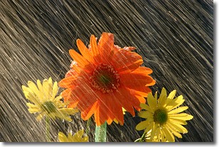
Weather Topic: What is Rain?
Home - Education - Precipitation - Rain
 Next Topic: Shelf Clouds
Precipitation in the form of water droplets is called rain.
Rain generally has a tendency to fall with less intensity over a greater period
of time, and when rainfall is more severe it is usually less sustained.
Rain is the most common form of precipitation and happens with greater frequency
depending on the season and regional influences. Cities have been shown to have
an observable effect on rainfall, due to an effect called the urban heat island.
Compared to upwind, monthly rainfall between twenty and forty miles downwind of
cities is 30% greater.
Next Topic: Shelf Clouds
Current conditions powered by WeatherAPI.com


