Weather Alert in New Mexico
Red Flag Warning issued March 13 at 9:47PM MDT until March 15 at 6:00PM MDT by NWS El Paso Tx/Santa Teresa NM
AREAS AFFECTED: Capitan And Sacramento Mountains
DESCRIPTION: ...CRITICAL FIRE CONDITIONS SATURDAY AND SUNDAY ACROSS SOUTHWEST, SOUTH CENTRAL NEW MEXICO AND FAR WEST TEXAS... High pressure nudging in from the west is causing temperatures to be well above seasonal averages, and relative humidity to be critically low this weekend. Daily highs Saturday and Sunday will average over 10 degrees above normal, as relative humidity values drops into the low teens and single-digits both days, with very poor overnight recovery. A two-day trough passage to our north will add increased winds mid afternoon on Saturday, which will continue and further strengthen overnight into Sunday. These winds combined with single digit RH's, warm temperatures, and drying fuels will lead to critical fire weather conditions. * AFFECTED AREA...Fire Weather Zone 113 Capitan and Sacramento Mountains/Lincoln NF/LNZ. * TIMING...Mid afternoon Saturday, Saturday night, through Sunday afternoon. * WINDS...West 35 to 45 mph with gusts up to 70 mph. * RELATIVE HUMIDITY...As low as 7 percent. * TEMPERATURES...Up to 76. * HIGHEST THREAT...is located on the eastern slopes of the Sacramento Mountains. * EXPERIMENTAL RFTI... 4 to 5 Marginally critical to critical. * IMPACTS...any fires that develop will likely spread rapidly. Outdoor burning is not recommended.
INSTRUCTION: A Red Flag Warning means that critical fire weather conditions are either occurring now, or will shortly. A combination of strong winds, low relative humidity, and warm temperatures can contribute to extreme fire behavior.
Want more detail? Get the Complete 7 Day and Night Detailed Forecast!
Current U.S. National Radar--Current
The Current National Weather Radar is shown below with a UTC Time (subtract 5 hours from UTC to get Eastern Time).

National Weather Forecast--Current
The Current National Weather Forecast and National Weather Map are shown below.

National Weather Forecast for Tomorrow
Tomorrow National Weather Forecast and Tomorrow National Weather Map are show below.

North America Water Vapor (Moisture)
This map shows recent moisture content over North America. Bright and colored areas show high moisture (ie, clouds); brown indicates very little moisture present; black indicates no moisture.

Weather Topic: What is Evaporation?
Home - Education - Precipitation - Evaporation
 Next Topic: Fog
Evaporation is the process which returns water from the earth
back to the atmosphere, and is another crucial process in the water cycle.
Evaporation is the transformation of liquid into gas, and it happens because
molecules are excited by the application of energy and turn into vapor.
In order for water to evaporate it has to be on the surface of a body of water.
Next Topic: Fog
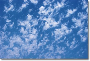
Weather Topic: What are Fractus Clouds?
Home - Education - Cloud Types - Fractus Clouds
 Next Topic: Freezing Rain
A fractus cloud (scud) is a fragmented, tattered cloud which has
likely been sheared off of another cloud. They are accessory clouds, meaning they
develop from parent clouds, and are named in a way which describes the original
cloud which contained them.
Fractus clouds which have originated from cumulus clouds are referred to as
cumulus fractus, while fractus clouds which have originated from stratus clouds
are referred to as stratus fractus. Under certain conditions a fractus cloud might
merge with another cloud, or develop into a cumulus cloud, but usually a
fractus cloud seen by itself will dissipate rapidly.
They are often observed on the leading and trailing edges of storm clouds,
and are a display of wind activity.
Next Topic: Freezing Rain
Current conditions powered by WeatherAPI.com


