Weather Alert in Illinois
Flood Warning issued March 9 at 7:55PM CDT until March 15 at 2:12PM CDT by NWS St Louis MO
AREAS AFFECTED: Clinton, IL
DESCRIPTION: ...The Flood Warning continues for the following rivers in Illinois...Missouri... Kaskaskia River at Carlyle. Big River at Byrnesville. ...The Flood Warning is extended for the following rivers in Missouri... Meramec River at Valley Park. Meramec River near Eureka. ...The Flood Warning is cancelled for the following rivers in Missouri... Meramec River near Sullivan. River forecasts are based on observed precipitation and forecast precipitation for the next 48 hours. * WHAT...Minor flooding is occurring and minor flooding is forecast. * WHERE...Kaskaskia River at Carlyle. * WHEN...Until Sunday afternoon. * IMPACTS...At 16.5 feet, Near this height, downstream agricultural fields begin flooding. * ADDITIONAL DETAILS... - At 7:30 PM CDT Monday the stage was 16.8 feet. - Recent Activity...The maximum river stage in the 24 hours ending at 7:30 PM CDT Monday was 16.9 feet. - Forecast...The river is expected to fall below flood stage Saturday morning and continue falling to 12.8 feet Monday, March 16. - Flood stage is 16.5 feet.
INSTRUCTION: Turn around, don't drown when encountering flooded roads. Most flood deaths occur in vehicles. Motorists should not attempt to drive around barricades or drive cars through flooded areas. Be especially cautious at night when it is harder to recognize the dangers of flooding. Rainfall heavier than forecast could cause river levels to rise even higher than predicted. The National Weather Service will monitor this developing situation and issue follow up statements as conditions change. This product, along with additional weather and stream information, is available at https://water.noaa.gov/wfo/lsx
Want more detail? Get the Complete 7 Day and Night Detailed Forecast!
Current U.S. National Radar--Current
The Current National Weather Radar is shown below with a UTC Time (subtract 5 hours from UTC to get Eastern Time).

National Weather Forecast--Current
The Current National Weather Forecast and National Weather Map are shown below.

National Weather Forecast for Tomorrow
Tomorrow National Weather Forecast and Tomorrow National Weather Map are show below.

North America Water Vapor (Moisture)
This map shows recent moisture content over North America. Bright and colored areas show high moisture (ie, clouds); brown indicates very little moisture present; black indicates no moisture.

Weather Topic: What are Nimbostratus Clouds?
Home - Education - Cloud Types - Nimbostratus Clouds
 Next Topic: Precipitation
A nimbostratus cloud is similar to a stratus cloud in its formless,
smooth appearance. However, a nimbostratus cloud is darker than a stratus cloud,
because it is thicker.
Unlike a stratus cloud, a nimbostratus cloud typically brings with it the threat
of moderate to heavy precipitation. In some cases, the precipitation may evaporate
before reaching the ground, a phenomenon known as virga.
Next Topic: Precipitation
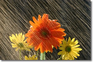
Weather Topic: What is Rain?
Home - Education - Precipitation - Rain
 Next Topic: Shelf Clouds
Precipitation in the form of water droplets is called rain.
Rain generally has a tendency to fall with less intensity over a greater period
of time, and when rainfall is more severe it is usually less sustained.
Rain is the most common form of precipitation and happens with greater frequency
depending on the season and regional influences. Cities have been shown to have
an observable effect on rainfall, due to an effect called the urban heat island.
Compared to upwind, monthly rainfall between twenty and forty miles downwind of
cities is 30% greater.
Next Topic: Shelf Clouds
Current conditions powered by WeatherAPI.com


