Weather Alert in Wyoming
Air Quality Alert issued August 22 at 12:33PM MDT by NWS Riverton WY
AREAS AFFECTED: Southwest Bighorn Basin
DESCRIPTION: The following message is transmitted on behalf of the Wyoming Department of Environmental Quality, Air Quality Division, and the Wyoming Department of Health. * WHAT...Air Quality Alert for Wildfire Smoke. * WHERE...Hot Springs County, mainly near the Red Canyon Wildfire in eastern Hot Springs County. * WHEN...Until 1 PM Friday August 22. * IMPACTS...Smoke from the Red Canyon Wildfire will result in poor air quality near the fire. A substantial decrease in smoke production from this fire has been observed, so the Air Quality Alert will be allowed to expire at 1 PM this afternoon. HEALTH INFORMATION...The Wyoming Department of Health recommends that the elderly, young children, and individuals with respiratory problems avoid excessive physical exertion and minimize outdoor activities during this time. Wildfire smoke is made up of a variety of pollutants, including particulate matter and ozone, which can cause respiratory health effects. Although these people are most susceptible to health impacts, the Department of Health also advises that everyone should avoid prolonged exposure to poor air quality conditions. CURRENT CONDITIONS...The Wyoming Department of Environmental Quality, Air Quality Division offers near real-time air quality data for Wyoming's monitoring stations and health effects information to help the public interpret current conditions. Current air quality conditions across the state of Wyoming can be found at http://www.wyvisnet.com/.
INSTRUCTION: N/A
Want more detail? Get the Complete 7 Day and Night Detailed Forecast!
Current U.S. National Radar--Current
The Current National Weather Radar is shown below with a UTC Time (subtract 5 hours from UTC to get Eastern Time).

National Weather Forecast--Current
The Current National Weather Forecast and National Weather Map are shown below.

National Weather Forecast for Tomorrow
Tomorrow National Weather Forecast and Tomorrow National Weather Map are show below.

North America Water Vapor (Moisture)
This map shows recent moisture content over North America. Bright and colored areas show high moisture (ie, clouds); brown indicates very little moisture present; black indicates no moisture.

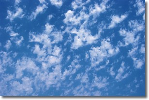
Weather Topic: What are Fractus Clouds?
Home - Education - Cloud Types - Fractus Clouds
 Next Topic: Freezing Rain
A fractus cloud (scud) is a fragmented, tattered cloud which has
likely been sheared off of another cloud. They are accessory clouds, meaning they
develop from parent clouds, and are named in a way which describes the original
cloud which contained them.
Fractus clouds which have originated from cumulus clouds are referred to as
cumulus fractus, while fractus clouds which have originated from stratus clouds
are referred to as stratus fractus. Under certain conditions a fractus cloud might
merge with another cloud, or develop into a cumulus cloud, but usually a
fractus cloud seen by itself will dissipate rapidly.
They are often observed on the leading and trailing edges of storm clouds,
and are a display of wind activity.
Next Topic: Freezing Rain
Weather Topic: What is Graupel?
Home - Education - Precipitation - Graupel
 Next Topic: Hail
Graupel is a form of precipitation that is created by atmospheric conditions
which cause supercooled water droplets to contact snow crystals and freeze to
their surface.
Sometimes known as soft hail or snow pellets, graupel is delicate and easily
destroyed by touch. Whereas hail usually falls during severe weather, graupel
doesn't require such conditions to form, and can form in mild precipitation
similar to situations which produce snowfall.
Next Topic: Hail
Current conditions powered by WeatherAPI.com


