Weather Alert in California
Cold Weather Advisory issued February 17 at 9:15PM PST until February 18 at 9:00AM PST by NWS San Francisco CA
AREAS AFFECTED: North Bay Interior Mountains; North Bay Interior Valleys; Southern Salinas Valley/Arroyo Seco and Lake San Antonio
DESCRIPTION: * WHAT...Cold conditions with temperatures as low as 32 expected. * WHERE...Southern Salinas Valley/Arroyo Seco and Lake San Antonio, North Bay Interior Mountains, and North Bay Interior Valleys. * WHEN...Until 9 AM PST Wednesday. * IMPACTS...Cold conditions will be hazardous to sensitive populations such as unhoused individuals. Prolonged exposure to the cold conditions will lead to hypothermia for people, pets, and livestock. Cold conditions may damage or kill sensitive crops, plants, and vegetation if appropriate precautions are not taken.
INSTRUCTION: Ensure portable heaters are working properly and are used correctly to avoid sparking a fire indoors. Do not use generators or grills inside as carbon monoxide poisoning can result. Check with your local, city, or county officials for information on available warming centers. Be sure to dress in layers if outdoors. Make sure that pets and livestock have adequate food, unfrozen water, and warmth. Cover or tend to sensitive crops, plants, and vegetation.
Want more detail? Get the Complete 7 Day and Night Detailed Forecast!
Current U.S. National Radar--Current
The Current National Weather Radar is shown below with a UTC Time (subtract 5 hours from UTC to get Eastern Time).

National Weather Forecast--Current
The Current National Weather Forecast and National Weather Map are shown below.

National Weather Forecast for Tomorrow
Tomorrow National Weather Forecast and Tomorrow National Weather Map are show below.

North America Water Vapor (Moisture)
This map shows recent moisture content over North America. Bright and colored areas show high moisture (ie, clouds); brown indicates very little moisture present; black indicates no moisture.

Weather Topic: What are Nimbostratus Clouds?
Home - Education - Cloud Types - Nimbostratus Clouds
 Next Topic: Precipitation
A nimbostratus cloud is similar to a stratus cloud in its formless,
smooth appearance. However, a nimbostratus cloud is darker than a stratus cloud,
because it is thicker.
Unlike a stratus cloud, a nimbostratus cloud typically brings with it the threat
of moderate to heavy precipitation. In some cases, the precipitation may evaporate
before reaching the ground, a phenomenon known as virga.
Next Topic: Precipitation
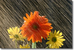
Weather Topic: What is Rain?
Home - Education - Precipitation - Rain
 Next Topic: Shelf Clouds
Precipitation in the form of water droplets is called rain.
Rain generally has a tendency to fall with less intensity over a greater period
of time, and when rainfall is more severe it is usually less sustained.
Rain is the most common form of precipitation and happens with greater frequency
depending on the season and regional influences. Cities have been shown to have
an observable effect on rainfall, due to an effect called the urban heat island.
Compared to upwind, monthly rainfall between twenty and forty miles downwind of
cities is 30% greater.
Next Topic: Shelf Clouds
Current conditions powered by WeatherAPI.com


