Weather Alert in Idaho
High Wind Warning issued March 13 at 8:37PM MDT until March 14 at 9:00PM MDT by NWS Pocatello ID
AREAS AFFECTED: Upper Snake River Plain
DESCRIPTION: ...BLOWING DUST WARNING REMAINS IN EFFECT FROM NOON TO 9 PM MDT SATURDAY... ...WIND ADVISORY WILL EXPIRE AT 9 PM MDT THIS EVENING... * WHAT...For the High Wind Warning, west winds 35 to 45 mph with gusts up to 65 mph expected. For the Blowing Dust Warning, widespread blowing dust expected. * WHERE...Upper Snake River Plain. * WHEN...For the High Wind Warning, from 9 AM to 9 PM MDT Saturday. For the Blowing Dust Warning, from noon to 9 PM MDT Saturday. * IMPACTS...Severely limited visibilities are expected. Travel will be dangerous and possibly life-threatening. Travel will be difficult, especially for high profile vehicles. Isolated damage to trees, powerlines, signs, and outbuildings is expected, along with isolated power outages. Loose outdoor objects will be blown around.
INSTRUCTION: Persons with respiratory problems should make preparations to stay indoors until the storm passes. Be ready for a sudden drop in visibility to near zero. If you encounter blowing dust or blowing sand on the roadway or see it approaching, pull off the road as far as possible and put your vehicle in park. Turn the lights all the way off and keep foot off the brake pedal. Remember, 'Pull Aside, Stay Alive'. Secure or bring inside loose outdoor objects before the high winds begin. During the high winds, avoid being outside in forested areas or around trees, branches, and powerlines. Use caution if you must drive, and keep both hands firmly on the steering wheel. Drivers of high profile vehicles should consider delaying travel until the high winds subside.
Want more detail? Get the Complete 7 Day and Night Detailed Forecast!
Current U.S. National Radar--Current
The Current National Weather Radar is shown below with a UTC Time (subtract 5 hours from UTC to get Eastern Time).

National Weather Forecast--Current
The Current National Weather Forecast and National Weather Map are shown below.

National Weather Forecast for Tomorrow
Tomorrow National Weather Forecast and Tomorrow National Weather Map are show below.

North America Water Vapor (Moisture)
This map shows recent moisture content over North America. Bright and colored areas show high moisture (ie, clouds); brown indicates very little moisture present; black indicates no moisture.

Weather Topic: What is Evaporation?
Home - Education - Precipitation - Evaporation
 Next Topic: Fog
Evaporation is the process which returns water from the earth
back to the atmosphere, and is another crucial process in the water cycle.
Evaporation is the transformation of liquid into gas, and it happens because
molecules are excited by the application of energy and turn into vapor.
In order for water to evaporate it has to be on the surface of a body of water.
Next Topic: Fog
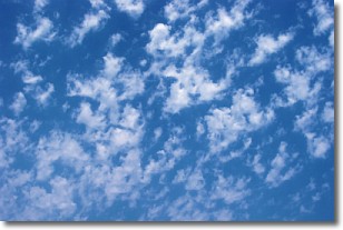
Weather Topic: What are Fractus Clouds?
Home - Education - Cloud Types - Fractus Clouds
 Next Topic: Freezing Rain
A fractus cloud (scud) is a fragmented, tattered cloud which has
likely been sheared off of another cloud. They are accessory clouds, meaning they
develop from parent clouds, and are named in a way which describes the original
cloud which contained them.
Fractus clouds which have originated from cumulus clouds are referred to as
cumulus fractus, while fractus clouds which have originated from stratus clouds
are referred to as stratus fractus. Under certain conditions a fractus cloud might
merge with another cloud, or develop into a cumulus cloud, but usually a
fractus cloud seen by itself will dissipate rapidly.
They are often observed on the leading and trailing edges of storm clouds,
and are a display of wind activity.
Next Topic: Freezing Rain
Current conditions powered by WeatherAPI.com


