Weather Alert in Idaho
Heat Advisory issued September 2 at 6:17PM PDT until September 4 at 8:00PM PDT by NWS Spokane WA
AREAS AFFECTED: Northern Panhandle; Idaho Palouse; Central Panhandle Mountains; Lewis and Southern Nez Perce Counties; Washington Palouse; Northeast Mountains; Okanogan Highlands; Central Chelan County; Western Okanogan County
DESCRIPTION: * WHAT...Hot temperatures. High temperatures 93 to 103 degrees. Limited overnight relief with low temperatures 58 to 65 degrees. * WHERE...Lookout Pass, Kellogg, St. Maries, Metaline Falls, Dobson Pass, Fourth Of July Pass, Wallace, Uniontown, Newport, Springdale-Hunters Road, Metaline, Leavenworth, Potlatch, Moscow, Sherman Pass, Mullan, Soldiers Meadow Road, Tekoa, Pullman, Republic, Ione, Schweitzer Mountain Road, Loup Loup Pass, Osburn, Chewelah, Rosalia, Fruitland, Athol, Kamiah, Methow, Clark Fork, La Crosse, Flowery Trail Road, Inchelium, Winthrop, Genesee, Plummer, Conconully, Tiger, Fernwood, Northport, Pinehurst, Colfax, Twisp, Kettle Falls, Oakesdale, Deer Park, Mazama, Winchester, Priest River, Craigmont, Nezperce, Orin-Rice Road, Highway 20 Wauconda Summit, Plain, Chesaw Road, Colville, Boulder Creek Road, Wauconda, Sandpoint, Bonners Ferry, and Eastport. * WHEN...Until 8 PM PDT Thursday. * IMPACTS...Hot temperatures will increase the risk of heat-related illnesses. Heat Risk of this magnitude impacts almost everyone who does not have access to adequate cooling or hydration.
INSTRUCTION: Drink plenty of fluids, stay in an air-conditioned room, stay out of the sun, and check up on relatives and neighbors.
Want more detail? Get the Complete 7 Day and Night Detailed Forecast!
Current U.S. National Radar--Current
The Current National Weather Radar is shown below with a UTC Time (subtract 5 hours from UTC to get Eastern Time).

National Weather Forecast--Current
The Current National Weather Forecast and National Weather Map are shown below.

National Weather Forecast for Tomorrow
Tomorrow National Weather Forecast and Tomorrow National Weather Map are show below.

North America Water Vapor (Moisture)
This map shows recent moisture content over North America. Bright and colored areas show high moisture (ie, clouds); brown indicates very little moisture present; black indicates no moisture.

Weather Topic: What are Cirrocumulus Clouds?
Home - Education - Cloud Types - Cirrocumulus Clouds
 Next Topic: Cirrostratus Clouds
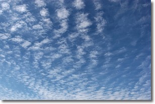
Cirrocumulus clouds form at high altitudes (usually around 5 km)
and have distinguishing characteristics displayed in a fine layer of
small cloud patches. These small cloud patches are sometimes referred to as
"cloudlets" in relation to the whole cloud formation.
Cirrocumulus clouds are formed from ice crystals and water droplets. Often, the
water droplets in the cloud freeze into ice crystals and the cloud becomes a
cirrostratus cloud. Because of this common occurrence, cirrocumulus cloud
formations generally pass rapidly.
Next Topic: Cirrostratus Clouds
Weather Topic: What are Cirrus Clouds?
Home - Education - Cloud Types - Cirrus Clouds
 Next Topic: Condensation
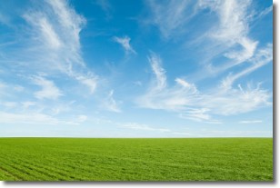
Cirrus clouds are high-level clouds that occur above 20,000 feet
and are composed mainly of ice crystals.
They are thin and wispy in appearance.
What do they indicate?
They are often the first sign of an approaching storm.
Next Topic: Condensation
Current conditions powered by WeatherAPI.com


